Begin in Wyck
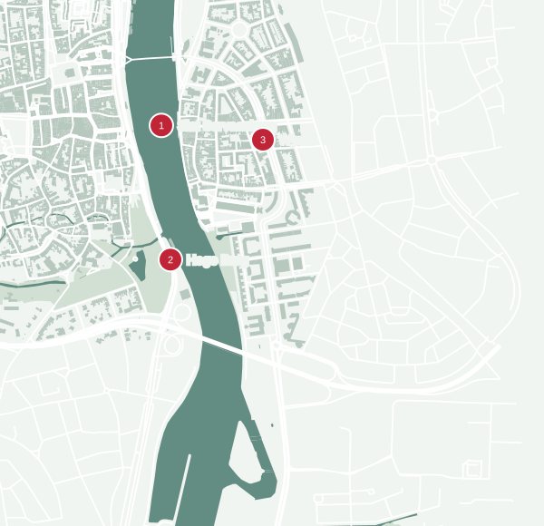
Start near Sint Servaasbrug on the east bank. If you are coming from the station, reach it by Stationsstraat and Wycker Brugstraat, with a detour along Rechtstraat if you want coffee first. Cross the old bridge towards the centre. Pause at the river before turning south along the west bank.
West bank to the park
Follow the river south, taking time for the view back towards the bridge. You can turn inland towards Onze Lieve Vrouweplein for the basilica or a meal. Return to the riverside and continue towards the park and Hoge Brug. Helpoort is close enough to add without turning this into a second full route.
Cross at Hoge Brug
Hoge Brug is the modern walking and cycling crossing linking the centre to Céramique. Opened in 2003, its arch supports the deck without piers standing in the river. The bridge has stairs and lifts at the ends; check local notices if you depend on the lifts.
Back through Céramique
On the east bank, head towards Plein 1992 and return north to Wyck. For a longer outing, first continue south towards Bonnefanten. For the compact loop, stay with the river and finish near your starting point. Allow roughly 60–90 minutes for the walk with short pauses; add separate time for museums or a meal.